|
|
| |
|
|
|
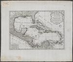 |
| Carte des isles de l'Amerique et de plusieurs pays de terre fermé situés au devant de ces Isles & autour du Golfe de Mexique |
|
| Creator: | | Anville, Jean-Baptiste Bourguignon d', 1697-1782 |
| Publisher: | | publisher not determined ( Place of publication not determined ) |
| Publication Date: | | 1731 |
| Type: | | Map |
| Format: | | 1 map : print, copper engraving, uncoloured ; 31 x 44 cm. |
| Source Institution: | | Universiteit Leiden |
| Subject Keyword: | |
Caribisch gebied
Kleine Antillen
|
| Spatial Coverage: | |
Caribisch gebied
Kleine Antillen
|
| Language: | | French |
|
| Carte des isles de l'Amerique et de plusieurs pays de terre fermé situés au devant de ces Isles & autour du Golfe de Mexique |
|
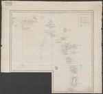 |
| Carte réduite des îles Antilles : au nord du 13me. degré de latitude, dressée sur plusieurs observations astronomiques et d'après des determinations de Longitude faites à la mer avec les horloges marines dans la Campagne de la Flore en 1771 et 1772 |
|
| Creator: | | Crenne, Verdun de la |
| Publication Date: | | 1775 |
| Type: | | Map |
| Format: | | 1 map : engraving ; 56 x 57 cm. |
| Source Institution: | | Universiteit Leiden |
| Subject Keyword: | |
Caribisch gebied
Kleine Antillen
Kaarten (geografie)
|
| Spatial Coverage: | |
Caribisch gebied
Kleine Antillen
|
| Genre: | | Kaarten (geografie) (gtt) |
| Language: | | French |
|
| Carte réduite des îles Antilles : au nord du 13me. degré de latitude, dressée sur plusieurs observations astronomiques et d'après des determinations de Longitude faites à la mer avec les horloges marines dans la Campagne de la Flore en 1771 et 1772 |
|
 |
| Carte des isles Antilles et du Golfe du Mexique : avec la majeure partie de la nouvelle Espagne |
|
| Creator: | | Bonne, Rigobert, 1727-1795 |
| Publisher: | | chés Latttré, graveur du Roi ( Paris ) |
| Publication Date: | | 1780 |
| Type: | | Map |
| Format: | | 1 map : copper gravure, color ; 65,5x142,5. |
| Source Institution: | | Universiteit Leiden |
| Subject Keyword: | |
Caribisch gebied
Kleine Antillen
Kaarten (geografie)
|
| Spatial Coverage: | |
Caribisch gebied
Kleine Antillen
|
| Genre: | | Kaarten (geografie) (gtt) |
| Language: | | French |
|
| Carte des isles Antilles et du Golfe du Mexique : avec la majeure partie de la nouvelle Espagne |
|
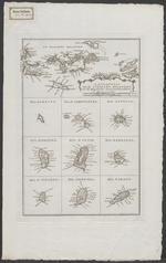 |
| Aanhangsel tot de Antilles eilanden, uit de Engelsche kaarten getrokken |
|
| Publication Date: | | 1785 |
| Type: | | Map |
| Format: | | 10 maps in 1 sheet : engraving ; 32x21 cm. |
| Source Institution: | | Universiteit Leiden |
| Subject Keyword: | |
Kleine Antillen
Caribisch gebied
Eilanden
Kaarten (geografie)
|
| Spatial Coverage: | |
Kleine Antillen
Caribisch gebied
Eilanden
|
| Genre: | | Kaarten (geografie) (gtt) |
| Language: | | Dutch |
|
| Aanhangsel tot de Antilles eilanden, uit de Engelsche kaarten getrokken |
|
|
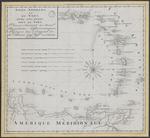 |
| Isles Antilles ou du Vent avec les Isles sous le vent : placées suivant les nouv.les observations astronomiques, redigées sur l'original de Mr. Bonne... |
|
| Publication Date: | | 1794 |
| Type: | | Map |
| Format: | | 1 krt. : manuscript, gekleurd. ; 41,5×45 cm. |
| Source Institution: | | Universiteit Leiden |
| Subject Keyword: | | Kleine Antillen |
| Spatial Coverage: | | Kleine Antillen |
| Language: | | French |
|
| Isles Antilles ou du Vent avec les Isles sous le vent : placées suivant les nouv.les observations astronomiques, redigées sur l'original de Mr. Bonne... |
|
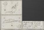 |
| The island of Becouya |
|
| Creator: | |
Heather, William, 1790-1812 fl
Stephenson, J, ca1780-ca1830 fl
|
| Publisher: | | Heather ( London ) |
| Publication Date: | | 1808 |
| Type: | | Map |
| Format: | | 5 maps in 1 sheet : copper gravure ; sheet 64x93 cm. |
| Source Institution: | | Universiteit Leiden |
| Subject Keyword: | |
Kleine Antillen
Caribisch gebied
Kaarten (vorm)
|
| Spatial Coverage: | |
Kleine Antillen
Caribisch gebied
|
| Genre: | | Kaarten (vorm) (gtt) |
| Language: | | English |
|
| The island of Becouya |
|
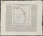 |
| Geographisch-statistische und historische Charte von den Westindischen Inseln über dem Winde oder die Zuckerinseln : Die Inseln ueber dem Winde |
|
| Publisher: | | Verlag des Geographischen Instituts ( Weimar ) |
| Publication Date: | | 1828 |
| Type: | | Map |
| Format: | | 1 map : engraving, color ; 31x28 cm, sheet 47,5x54 cm. |
| Source Institution: | | Universiteit Leiden |
| Subject Keyword: | |
Caribisch gebied
Kleine Antillen
Kaarten (vorm)
|
| Spatial Coverage: | |
Caribisch gebied
Kleine Antillen
|
| Genre: | | Kaarten (vorm) (gtt) |
| Language: | | German |
|
| Geographisch-statistische und historische Charte von den Westindischen Inseln über dem Winde oder die Zuckerinseln : Die Inseln ueber dem Winde |
|
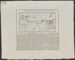 |
| Die Inseln unter dem Winde |
|
| Creator: | | Verlag des Geographischen Instituts |
| Publisher: | | Verlag des Geographischen Instituts ( Weimar ) |
| Publication Date: | | 1829 |
| Type: | | Map |
| Format: | | 1 map : engraving, color ; 20x37 cm, sheet 41,5x43 cm. |
| Source Institution: | | Universiteit Leiden |
| Subject Keyword: | |
Caribisch gebied
Kleine Antillen
Kaarten (vorm)
|
| Spatial Coverage: | |
Caribisch gebied
Kleine Antillen
|
| Genre: | | Kaarten (vorm) (gtt) |
| Language: | | German |
|
| Die Inseln unter dem Winde |
|
|
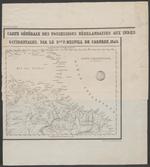 |
| Carte génŕale des possesions Néerlandaises aux Indes Occidentales |
|
| Creator: | | Melvill de Carnbee, P |
| Publication Date: | | 1846 |
| Type: | | Map |
| Format: | | 1 map : lithography ; 23,5 x 28 cm. |
| Source Institution: | | Universiteit Leiden |
| Subject Keyword: | |
Kleine Antillen
Caribisch gebied
Kaarten (vorm)
|
| Spatial Coverage: | |
Kleine Antillen
Caribisch gebied
|
| Genre: | | Kaarten (vorm) (gtt) |
| Language: | | French |
|
| Carte génŕale des possesions Néerlandaises aux Indes Occidentales |
|
 |
| Kaart van de colonie Suriname, en van de Nederlandsche bezittingen in West-Indië en op de kust van Guinea |
|
| Creator: | |
Geest, E. de
Seyffardt's Boekhandel (Amsterdam)
|
| Publisher: | | Seyffardt's Boekhandel ( Amsterdam ) |
| Publication Date: | | 1862 |
| Type: | | Map |
| Format: | | 4 maps in 1 sheet : lithography, color ; sheet 27x37 cm. |
| Source Institution: | | Universiteit Leiden |
| Subject Keyword: | |
Suriname (land)
Kleine Antillen
Caribisch gebied
Kaarten (geografie)
|
| Spatial Coverage: | |
Suriname (land)
Kleine Antillen
Caribisch gebied
|
| Genre: | | Kaarten (geografie) (gtt) |
| Language: | | Dutch |
|
| Kaart van de colonie Suriname, en van de Nederlandsche bezittingen in West-Indië en op de kust van Guinea |
|
 |
| Kaart van het eiland St. Eustatius |
|
| Creator: | | Blanken Jzn, W |
| Publication Date: | | 1907 |
| Type: | | Map |
| Format: | | 1 map : photocopy ; 21×27,5 cm. |
| Source Institution: | | Universiteit Leiden |
| Subject Keyword: | |
Caribisch gebied
Kleine Antillen
Kaarten (vorm)
|
| Spatial Coverage: | |
Caribisch gebied
Kleine Antillen
|
| Genre: | | Kaarten (vorm) (gtt) |
| Language: | | Dutch |
|
| Kaart van het eiland St. Eustatius |
|
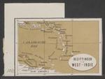 |
| Bezittingen in West-Indie |
|
| Publication Date: | | [1869] |
| Type: | | Map |
| Format: | | 1 map : lithography, color ; sheet 7x10,5 cm. |
| Source Institution: | | Universiteit Leiden |
| Subject Keyword: | |
Caribisch gebied
Kleine Antillen
Kaarten (geografie)
|
| Spatial Coverage: | |
Caribisch gebied
Kleine Antillen
|
| Genre: | | Kaarten (geografie) (gtt) |
| Language: | | Dutch |
|
| Bezittingen in West-Indie |
|
|
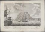 |
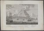
| Gezigt van het Eyland St. Eustatius Den Wel Eerwaardigen Heere Conradus Schwiers S.S. Th. Dr. en Gewezen Predikant te St. Eustatius word deeze Plaat Opgedragen, door zij Wel Eerw. D.W. Dienaar G.T. van Paddenburg |
|
| Creator: | |
Bendorp, K.F, 1736-1814
Paddenburg, Gijsbert Thieme van
|
| Publication Date: | | [approximately 1780] |
| Type: | | Photograph |
| Format: | | 1 print in 2 sheets : etching/copper engraving ; each sheet 26 x 41,5 cm. |
| Source Institution: | | Universiteit Leiden |
| Subject Keyword: | |
Caribisch gebied
Kleine Antillen
|
| Spatial Coverage: | |
Caribisch gebied
Kleine Antillen
|
| Language: | | Dutch |
|
| Gezigt van het Eyland St. Eustatius Den Wel Eerwaardigen Heere Conradus Schwiers S.S. Th. Dr. en Gewezen Predikant te St. Eustatius word deeze Plaat Opgedragen, door zij Wel Eerw. D.W. Dienaar G.T. van Paddenburg |
|
 |
| Kaart van de Antilles of eil. boven den wind met het oostelyk gedeelte der eil. beneden den wind |
|
| Publisher: | | Matthijs Schalekamp ( Amsterdam ) |
| Publication Date: | | [1785] |
| Type: | | Map |
| Format: | | 1 kaart. : kopergrav. ; 31,5 x 21 cm. |
| Source Institution: | | Universiteit Leiden |
| Subject Keyword: | | Kleine Antillen |
| Spatial Coverage: | | Kleine Antillen |
| Language: | | Dutch |
|
| Kaart van de Antilles of eil. boven den wind met het oostelyk gedeelte der eil. beneden den wind |
|
 |
| Pascaerte vande Caribische eylanden, vande Barbados tot aende bocht van Mexico |
|
| Creator: | | Doncker, Hendrik, 1625/6-1699 |
| Publication Date: | | [1659] |
| Type: | | Map |
| Format: | | 1 map : copper gravure, color ; 43,5x54,5 cm. |
| Source Institution: | | Universiteit Leiden |
| Subject Keyword: | |
Caribisch gebied
Kleine Antillen
Kaarten (geografie)
|
| Spatial Coverage: | |
Caribisch gebied
Kleine Antillen
|
| Genre: | | Kaarten (geografie) (gtt) |
| Language: | | Dutch |
|
| Pascaerte vande Caribische eylanden, vande Barbados tot aende bocht van Mexico |
|
|
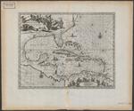 |
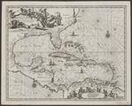
| Insulae Americanae in Oceano Septentrionali cum Terris adiacentibus |
|
| Creator: | | Ogilby, John, 1600-1676 |
| Publication Date: | | [1671] |
| Type: | | Map |
| Format: | | 1 map : copper gravure ; 29x36 cm. |
| Source Institution: | | Universiteit Leiden |
| Subject Keyword: | |
Caribisch gebied
Kleine Antillen
Kaarten (geografie)
|
| Spatial Coverage: | |
Caribisch gebied
Kleine Antillen
|
| Genre: | | Kaarten (geografie) (gtt) |
| Language: | | Latin |
|
| Insulae Americanae in Oceano Septentrionali cum Terris adiacentibus |
|
 |
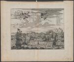
| Insulae Americanae in Oceano Septentrionali cum terris adiacentibus |
|
| Creator: | | Montanus, Arnoldus |
| Publication Date: | | [1670] |
| Type: | | Map |
| Format: | | 1 map : copper gravure ; 29×36,5 cm. |
| Source Institution: | | Universiteit Leiden |
| Subject Keyword: | |
Caribisch gebied
Kleine Antillen
Kaarten (geografie)
|
| Spatial Coverage: | |
Caribisch gebied
Kleine Antillen
|
| Genre: | | Kaarten (geografie) (gtt) |
| Language: | | Latin |
|
| Insulae Americanae in Oceano Septentrionali cum terris adiacentibus |
|
 |
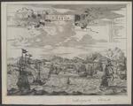
| De Stadt St. Martin |
|
| Creator: | | Montanus, A |
| Publication Date: | | [1670] |
| Type: | | Photograph |
| Format: | | 1 print : etching/copper engraving ; 27,5 x 36 cm. |
| Source Institution: | | Universiteit Leiden |
| Subject Keyword: | |
Caribisch gebied
Kleine Antillen
|
| Spatial Coverage: | |
Caribisch gebied
Kleine Antillen
|
| Language: | | Dutch |
|
| De Stadt St. Martin |
|
|