| |
|
|
|
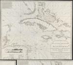 |
| A new and accurate Mercators chart of the Bay of Honduras, Mosquito Shore and the British Yucatan, also the Bahama Islands : including Jamaica, Cuba, Hispaniola, part of East Florida &c |
|
| Creator: | | Steel, D |
| Publisher: | | D. Steel ( London ) |
| Publication Date: | | 1800 |
| Type: | | Map |
| Format: | | 1 map : copper gravure ; 107x120 cm. |
| Source Institution: | | Universiteit Leiden |
| Subject Keyword: | |
Caribisch gebied
Kaarten (vorm)
|
| Spatial Coverage: | | Caribisch gebied |
| Genre: | | Kaarten (vorm) (gtt) |
| Language: | | English |
|
| A new and accurate Mercators chart of the Bay of Honduras, Mosquito Shore and the British Yucatan, also the Bahama Islands : including Jamaica, Cuba, Hispaniola, part of East Florida &c |
|
|
|
|
|
